Land of the Widrym
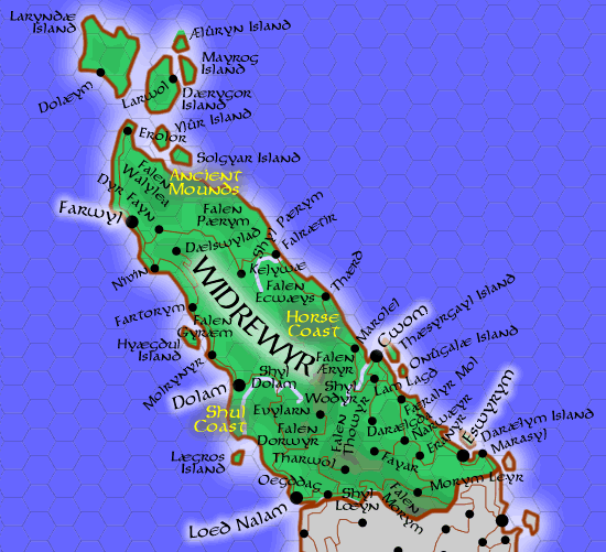
Map of Widrèwyr, Ildûn, ca. 653 DR
Regions, Geographic
Widrèwyr is bounded by the Mar Dekàli to the east and west, and the Ælyri province of Tiréwyr to the south.
- Ancient Mounds. Scattered across the northern reaches of Widrèwyr are hundreds of earthen mounds constructed by ancient inhabitants. Most are believed to be burial mounds, though some are rumored to contain treasures and other secrets. Additionally, local traditions identify a number of the hills as Feyri mounds. These hills mark places where the barriers between worlds are porous.
- Horse Coast
- Shūl Coast
Regions, Political
Cities, Towns, and Villages
- Town of Cwom
- Town of Dolam
- Town of Eswyrym
- Town of Farwyl
- Town of Lōed Nalam
- Town of Mōlumæ
- Village of Dælswylad
- Village of Darælgda
- Village of Dōlæym
- Village of Erányr
- Village of Erōlor
- Village of Evylarn
- Village of Færályr Mol
- Village of Falrætir
- Village of Fartòrym
- Village of Fayar
- Village of Kelywæ
- Village of Lam Làgd
- Village of Larwol
- Village of Marásyl
- Village of Marōlel
- Village of Molrynyr
- Village of Morym Leyr
- Village of Narwæyr
- Village of Nivin
- Village of Oegddag
- Village of Thærd
- Village of Tharwol